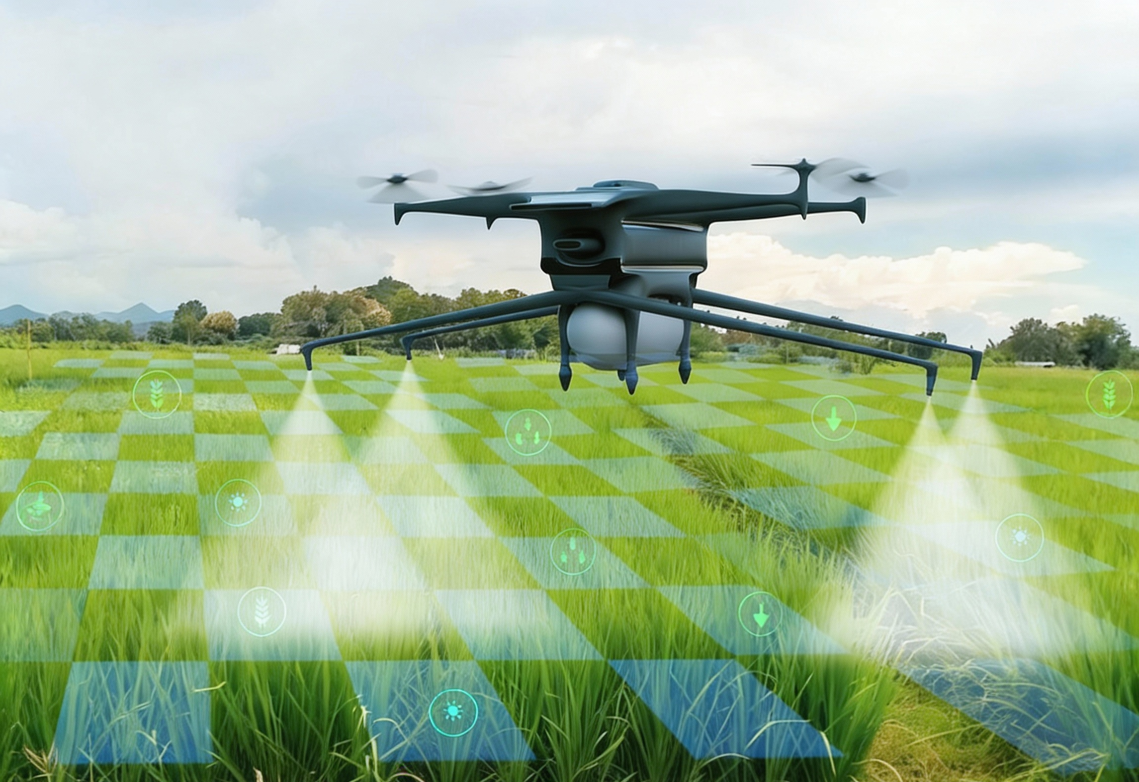
Precision Agriculture leverages advanced drone technology, sensors, and data analytics to optimize farming operations with accuracy and efficiency. By capturing high-resolution aerial imagery and multispectral data, farmers can monitor crop health, soil conditions, irrigation patterns, and pest or disease stress in real time.
This data-driven approach enables targeted interventions—such as variable-rate fertilization, irrigation, and spraying—reducing input costs while increasing crop yield and sustainability. Precision Agriculture helps farmers make informed decisions, improve productivity, conserve resources, and minimize environmental impact across the entire crop lifecycle.
Seed Sowing
Aerial Seeding using Drones
Overview
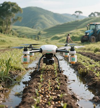
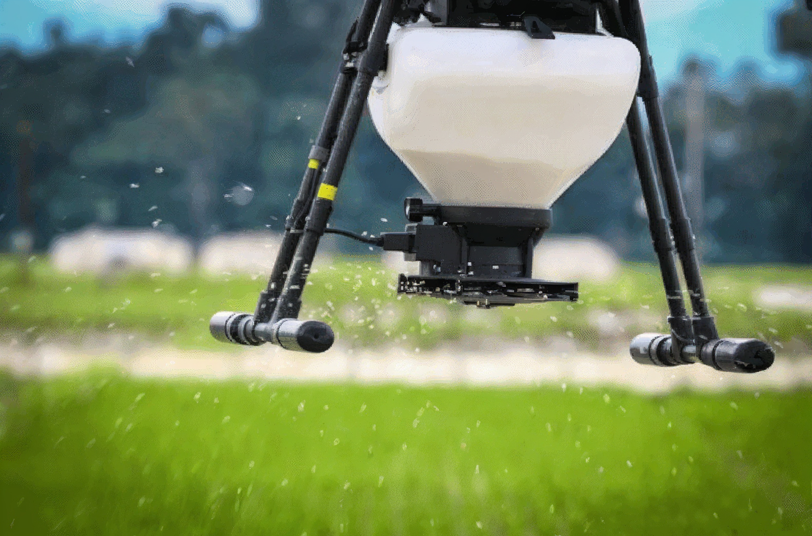
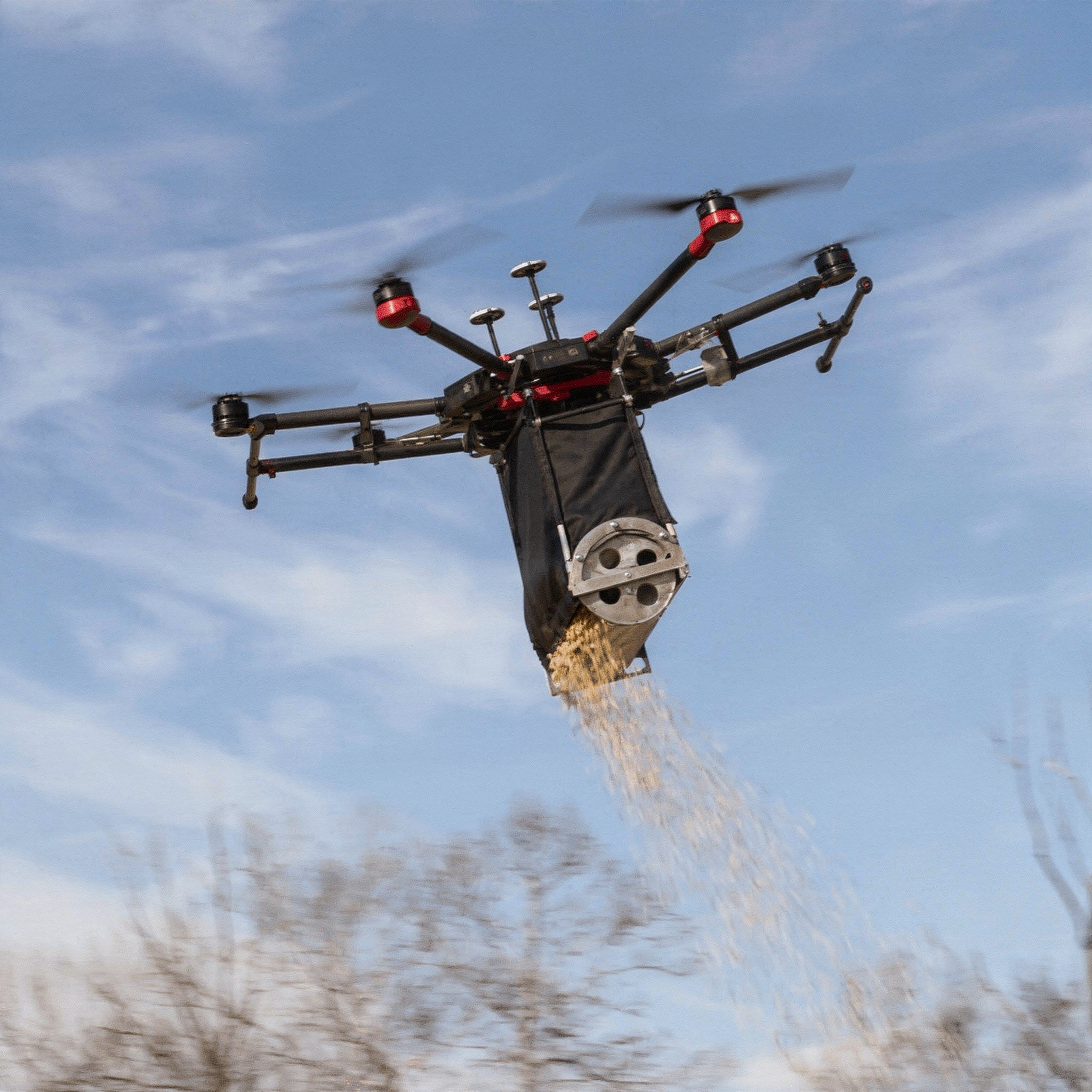
Aerial seeding using drones enables efficient and rapid dispersal of seeds over large or hard-to-access areas, offering a modern alternative to traditional sowing methods. This approach is especially valuable for pasture rejuvenation, cover cropping, reforestation, and restoration of degraded lands. Equipped with GPS navigation and onboard sensors, drones precisely release seed balls or granules, minimizing seed wastage and improving germination rates. As drones operate without ground contact, soil compaction is avoided, preserving soil structure and health. Aerial seeding is eco-friendly, cost-effective, and capable of covering challenging terrains quickly, while supporting sustainable agriculture through optimized seed distribution based on real-time field data.
Process Flow
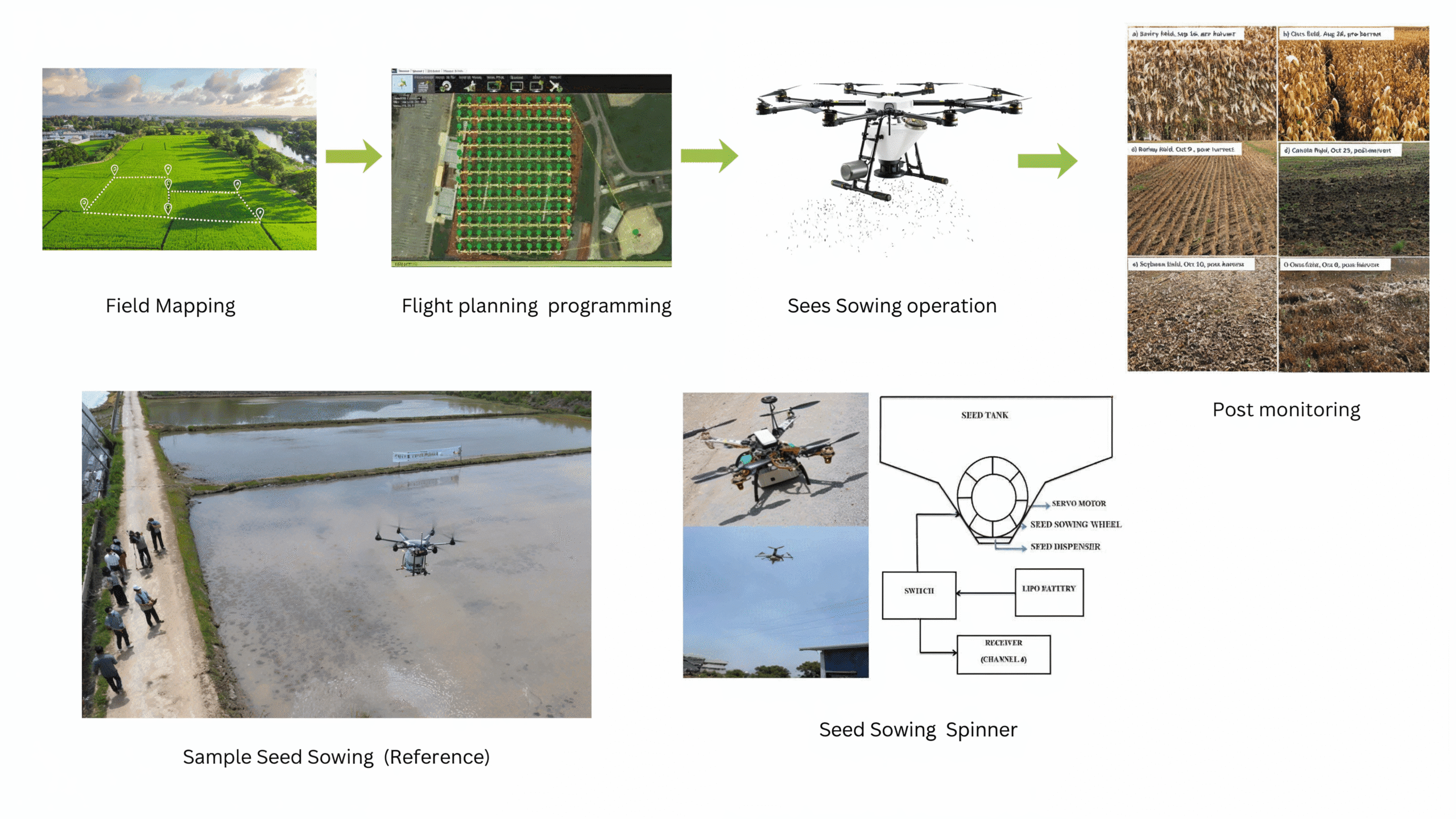
The flow process of seed sowing begins with Field Mapping, where the agricultural field is surveyed to define boundaries and terrain conditions. This data is used for Flight Planning and Programming, where an optimized flight path is created using mission planner software to ensure complete field coverage. The drone, equipped with a Seed Sowing Mechanism consisting of a seed tank, servo motor, and spinner disc, then performs the Sowing Operation. The spinner disc helps distribute the seeds uniformly across the ground surface, though not in perfect alignment. This slight randomness in seed placement is beneficial for broadcast or non-row crops, where even but non-linear distribution improves natural spacing and germination.Finally, Post Monitoring is carried out to evaluate germination, crop growth, and sowing efficiency. This entire process enhances precision, reduces labor, and ensures effective sowing.
Reference Image
Relevant Outcomes / Deliverables
| Deliverable | Usage |
|---|---|
| Uniform Seed Distribution | Consistent and precise seed placement across the target area |
| Reduced Labor and Time | Faster sowing operations with minimal human effort |
| Coverage Data and Maps | Flight logs, seeding maps, and area coverage reports for documentation |
| Improved Germination Efficiency | Optimized seed spacing enhances crop establishment and yield |
| Accessibility to Difficult Terrains | Effective seeding in hilly, flooded, or inaccessible regions |
| Sustainable Land Restoration | Supports reforestation, soil conservation, and ecological recovery |
Achievable Accuracy
| Parameter | Typical Accuracy | Depends On |
|---|---|---|
| Positioning Accuracy | ±5–10% | RTK / GPS setup |
| Seeder Distribution | ±5–10% | Variation across the target area |
| Sensor Accuracy | ±2–3% | Environmental conditions |
Key Advantages
- Enables rapid sowing over large areas in minimal time
- Ensures consistent seed spread for improved germination
- Reduces dependence on manual planting and field labor
- Operates effectively in hilly, marshy, or hazardous terrains
- GPS-guided flight and calibrated dispensers enhance accuracy
- Lowers operational and manpower costs compared to traditional methods
- Minimizes soil compaction and surface disturbance
- Suitable for both small farms and large-scale reforestation projects
- Provides real-time mapping and seeding reports for monitoring
- Supports sustainable agriculture, reforestation, and soil conservation initiatives
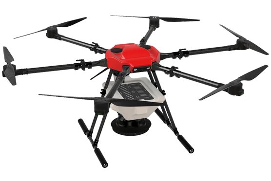
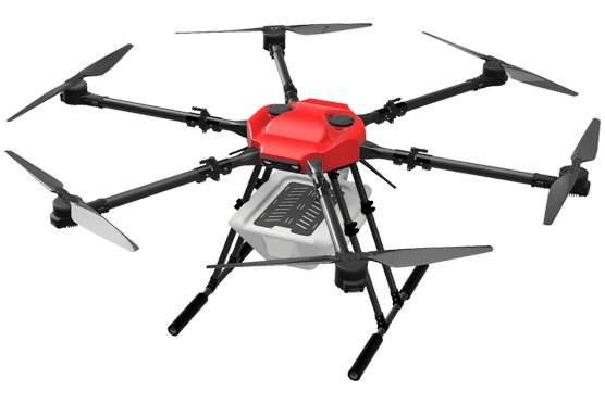
Compatible Drone Platforms
- Aranya
Supported Sensors / Payloads
- 10–15 kg payload capacity
- Seed dispenser module
- Hopper with variable flow control
- GNSS with terrain-following sensor
Industry Segments Benefited
- Forestry & Environmental Conservation
- Agriculture Sector
- Government & Public Sector
- Agri-Tech & Drone Service Providers
- Research and Educational Institutions
References
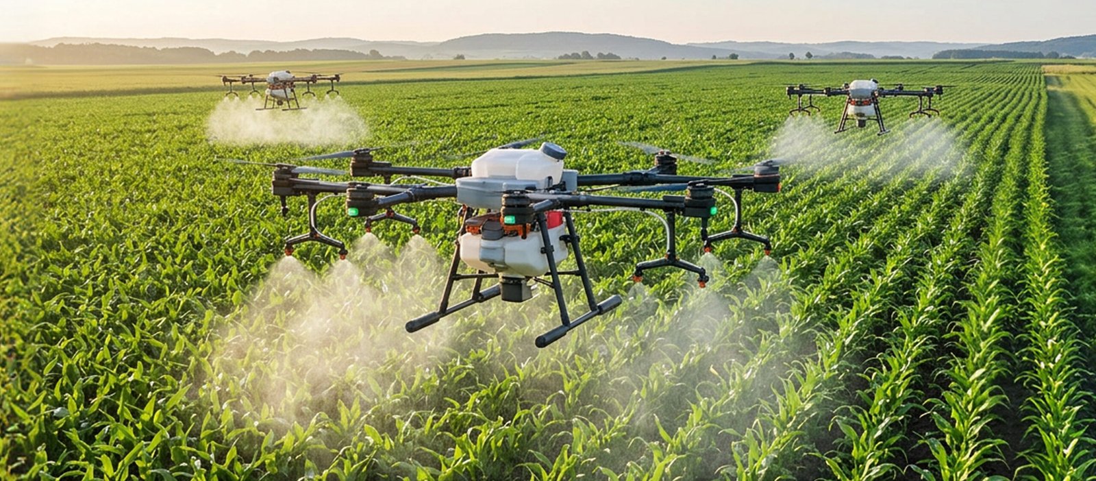
Precision Spraying
Precision Spraying (Fertilizers & Pesticides)
Overview
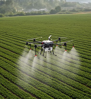
Precision spraying is an advanced agricultural application that enables accurate and efficient application of pesticides, fertilizers, and herbicides across farmlands. Equipped with GPS navigation, automated flight control, and intelligent spraying nozzles, agricultural drones ensure uniform chemical distribution while minimizing wastage and human exposure. These drones can operate effectively over uneven, hilly, or inaccessible terrains, making them ideal for large-scale and precision farming. By integrating sensors and AI-based mapping, drone-based spraying supports sustainable agriculture through targeted treatment, reduced resource usage, and improved crop productivity.
Process Flow
The image represents the process flow of a smart agricultural spraying drone. It shows how the drone uses terrain-following and obstacle detection sensors to map the ground elevation and identify obstacles like trees or poles. When an obstacle is detected, the sprayer automatically stops to ensure safety and prevent wastage. Once the path is clear, the system adjusts parameters such as droplet size, flow rate, altitude, and speed for precise spraying. This process ensures accurate pesticide or fertilizer application, improving efficiency and reducing chemical usage in the field.
Reference Image
Relevant Outcomes / Deliverables
| Deliverable | Usage |
|---|---|
| Uniform Crop Coverage | Consistent and precise application of agrochemicals across the entire field |
| Reduced Chemical Usage | Optimized spraying patterns minimize wastage and overuse of inputs |
| Time & Labor Efficiency | Faster spraying operations with reduced manpower and manual effort |
| Data & Mapping Reports | Flight logs, spray maps, and area coverage data for documentation and analysis |
Achievable Accuracy
| Parameter | Typical Accuracy | Depends On |
|---|---|---|
| Positioning Accuracy | ±5–10% | RTK / GPS setup |
| Droplet Distribution | ±5–10% | Variation across the target area |
| Sensor Accuracy | ±2–3% | Environmental conditions |
Key Advantages
- Ensures accurate and uniform spraying using GPS and intelligent control systems
- Covers large agricultural areas quickly compared to manual methods
- Optimized spray patterns reduce overuse of pesticides and fertilizers
- Minimizes human exposure to harmful agrochemicals
- Operates efficiently in uneven, hilly, or waterlogged terrains
- Lowers labor and operational costs over time
- Supports digital mapping and record-keeping for smart farm management
Compatible Drone Platforms
- Varuna
- Indra
Supported Sensors / Payloads
- 10–30 litre chemical payload capacity
- Sprayer tank with atomizing nozzles
- Flow sensor and pump control system
- RTK GPS for precision spraying
- Obstacle avoidance radar
Industry Segments Benefited
- Agriculture Sector
- Agrochemical Industry
- Agri-Tech & Drone Service Providers
- Research and Education Institutions
References
- Development of a precision farming system based on the use of UAVs for spraying pesticides and fertilizers
- Frontiers – Research on a UAV spray system combined with grid atomized droplets
- Study on plant protection UAV spraying technology based on thrips population activity patterns during the cotton flowering period (PMC)
Precision Fertigation and Input Optimization
Aerial Precision Nutrient & Water Management
Overview
Precision fertigation is an advanced agricultural approach that delivers the exact amount of nutrients and water required by crops with high accuracy. By integrating soil-moisture sensors, crop-health analytics, and variable-rate control, the system identifies zones experiencing nutrient deficiency or water stress. Using drone-based or automated platforms, nutrients and water are applied only to these specific areas instead of uniformly across the entire field. This targeted delivery improves nutrient uptake, prevents over-watering and nutrient runoff, reduces resource wastage, and enhances crop growth. By optimizing the timing, quantity, and placement of inputs, precision fertigation improves yield quality while supporting sustainable and cost-efficient farm management.
Process Flow

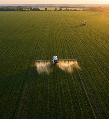
Image source : India’s Best Drone Survey Company for UAV Aerial and Mapping – Envoler Innovations Croptracker – Drone Technology In Agriculture
The process begins with Drone-Based Crop Monitoring, where multispectral or hyperspectral sensors scan the field to generate nutrient-status maps. These maps highlight low-nutrient and stressed zones using vegetation indices such as NDVI and NDRE. Once these deficient areas are identified, a Targeted Spraying Drone is deployed to apply nutrients or water only where required. During application, the system dynamically adjusts droplet size and flow rate based on crop requirements, ensuring efficient and uniform nutrient delivery to affected zones. This data-driven approach minimizes wastage, improves crop health, and optimizes overall input usage.
Reference Images
Relevant Outcomes / Deliverables
| Category | Outcome / Deliverable |
|---|---|
| Field Analysis | High-resolution nutrient variability maps identifying low-nutrient zones |
| Crop Health Insights | Detailed NDVI / NDRE vegetation index reports for stress detection |
| Precision Application Plan | Geo-referenced spraying maps for targeted nutrient delivery |
| Nutrient Application | Optimized spraying with dynamic droplet-size adjustment |
| Resource Efficiency | Reduced nutrient wastage and improved fertilizer utilization |
| Performance Report | Before-and-after crop health comparison with measurable improvements |
| Operational Efficiency | Reduced manual effort and faster field coverage |
| Documentation | Final summary report with actionable agronomic recommendations |
Achievable Accuracy
| Parameter | Achievable Accuracy |
|---|---|
| Nutrient Delivery Accuracy | ±5–10% |
| Water Application Accuracy | ±5% |
| Flow Rate Control | ±3% deviation |
| Target Area Coverage | 95% uniformity |
| Reduction in Nutrient Wastage | Up to 30% improvement |
Key Advantages
- Reduced nutrient and water wastage through optimized delivery
- Improved nutrient uptake and crop efficiency
- Significant cost savings on fertilizers and irrigation
- Uniform application across varied terrain and crop zones
- Lower environmental impact with reduced runoff and leaching
- Data-driven insights for improved farm management decisions
- Reduced human error through automated dosing control
- Adaptable for multiple crops, soil types, and growth stages
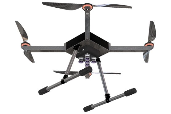
Compatible Drone Platforms
- Drishti
- Drishti Pro
Supported Sensors / Payloads
- Multispectral camera for NDVI / NDRE analysis
- RGB camera for visual field mapping
- Spraying or dispensing module for corrective application
Industry Segments Benefited
Agriculture & Agritech, Forestry & Environmental Conservation, Environmental & Climate Agencies, Urban Planning & Land Management, Water Resource & Coastal Management, Disaster Management, Insurance & Risk Assessment.