
Blast Monitoring & Analysis using Drones
Overview
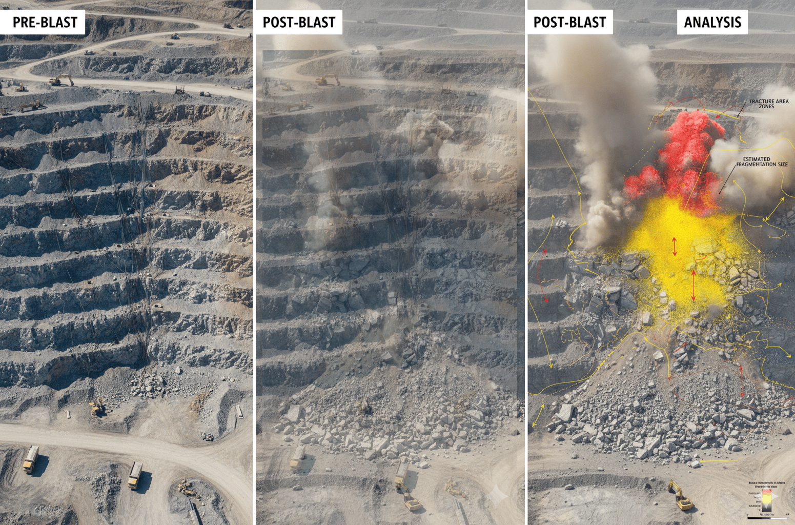
Drone-based blast monitoring enables accurate and objective assessment of blasting operations in mining and quarrying environments. By capturing high-resolution aerial data before and after blasting events, drones provide precise evaluation of blast effectiveness, fragmentation quality, and material displacement. In addition, aerial monitoring of dust and debris dispersion supports operational safety and ensures compliance with environmental regulations. This data-driven approach helps optimize blast design, reduce secondary blasting, minimize environmental impact, and enhance overall operational efficiency.
Process Flow

Reference Image
Relevant Outcomes / Deliverables
| Deliverable | Format | Usage |
|---|---|---|
| Pre / Post-Blast Orthomosaic | GeoTIFF | Visual comparison |
| Fragmentation Analysis | PDF / CSV | Blast performance evaluation |
| Dust & Debris Dispersion Map | GeoTIFF / PDF | Safety and compliance |
| Blast Assessment Report | Planning and optimization |
Achievable Accuracy
| Parameter | Typical Accuracy | Depends On |
|---|---|---|
| Spatial Accuracy | ±3–5 cm | RTK/PPK integration, GCPs |
| Fragmentation Analysis | High (relative) | Image resolution & overlap |
| Dust Spread Detection | Qualitative / Quantitative | Sensor type and weather conditions |
Key Advantages
- Objective evaluation of blast effectiveness
- Improved fragmentation and reduced secondary blasting
- Enhanced safety through dust and debris monitoring
- Data-backed optimization of blast design
Compatible Drone Platforms
- Multirotor UAVs for high-detail blast area surveys
- Fixed-wing UAVs for large blast zones
Supported Sensors / Payloads
- High-resolution RGB Cameras
- Multispectral or optical sensors for dust analysis
Industry Segments Benefited
- Mining Operations
- Quarry Management
- Explosives & Blasting Engineers
- Environmental Compliance Teams
No sub drone applications found for this category.