With advancements in agricultural practices, soil contamination has become a significant challenge with the implementation of effective soil remediation. Industrial influences, excessive pesticide use, and many human impacts have led to the pollution of areas of soil.
New technologies, including agricultural drones, are expected to better address this growing concern. Unlike traditional methods of detection and management of soil pollution, drones aid in soil remediation through mapping that helps restore once-polluted lands, making farming more sustainable.
The Need for Soil Remediation
Industrial wastes, agricultural inputs, and semi-urban runoff contribute to soil pollution. Contaminated soil affects crop yield, soil health, and long-term environmental quality. This issue significantly impacts farmers, especially with the sharp rise in global food demand. The need for effective soil remediation strategies is more urgent than ever.
Detecting Soil Contamination with Precision
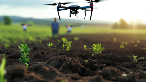
Agri drones due to their advanced sensors, such as multispectral and hyperspectral cameras, can survey vast areas quickly and precisely. These drones gather data on soil composition at high temporal resolution. They create maps that detect abnormal chemical signatures or differences in soil properties, highlighting potentially contaminated areas.
Support drones help farmers gather essential data on nutrients, moisture levels, and harmful pollutants in the soil. This data is crucial for determining the extent of contamination. It allows landowners to pinpoint exact areas for remediation, enabling them to use resources more effectively.
Mapping Contaminated Zones
Once contaminated sites are localized, agricultural drones generate high-definition maps that can be used by the farmers as well as the environment to know the exact spots where intervention is needed. The maps are vital in planning soil remediation works, as treatment will be administered only to affected areas.
Therefore, the maps simplify communication across all stakeholders working on the remediation projects by visually depicting the level of contamination in an area. This visualization provides critical information for making strategic decisions and enhances collaboration among farmers, scientists, and environmental organizations.
Facilitating Targeted Soil Remediation
Because of their capability to deliver optimal precision in soil remediation, agricultural drones are perhaps one of the most important tools in farming. In fact, they are capable of delivering accurate measures of soil amendments and remediation agents to contaminated areas for effective treatment without wasting them on other areas of land.
As precision makes the process of soil remediation more efficient, it also minimizes the impact of the whole exercise on the environment. For instance, in the case where fertilizer or some chemical treatments are applied in huge amounts, they will only be put on areas where needed by the drones, avoiding runoff and further contamination.
Monitoring Soil Health Over Time
Soil remediation is not a one-time thing; it requires continuous monitoring to make sure that contamination levels are going down and the fertility of the land is regaining. Agricultural drones facilitate this by taking data at regular intervals, which allows comparisons with previous contamination levels.
This monitoring must be ongoing to evaluate whether the remediation of soils is being effective. The farmer can trace changes in soil composition over time and adjust strategies and interventions for the best outcomes. The adaptive management approach thus ensures that the process of remediation of soils remains dynamic and responsive to the land.
Drone-based Soil Remediation and Contamination Mapping
This table summarizes the key features of a research study on drone-based high-resolution aerial imaging and machine learning for mapping soil contamination to support soil remediation efforts.
| Aspect | Details |
| Objective | Use agriculture drones with HRAI and machine learning to predict soil contamination and guide remediation. |
| Study Area | Zhongxiang, Hubei, China |
| Key Method | High-Resolution Aerial Imaging (HRAI) combined with machine learning algorithms (ERF, RF). |
| Performance | ERF algorithm achieved 87% accuracy, outperforming traditional methods like Kriging interpolation. |
| Risk Categorization | Soil contamination categorized as low (66.9%), medium (29.4%), and high risk (3.7%). |
| Key Feature Extraction | Identified features: RGB values, vegetation, and pollution sources (e.g., fertilizer factories). |
| Impact | Efficiently identifies contaminated areas for targeted remediation, improving soil quality for agriculture. |
Unlocking New Agricultural Potential
Even soil remediation using drones can unlock thousands of acres that were previously uncultivable. Farmers once had barren land, but now they can turn it into fertile ground for crops by managing contamination with agricultural drones.
Economic returns from land reclamation through soil remediation include enhanced operational capacity. Drones can transform previously marginalized land into productive agricultural fields. This leads to improved soil environments, which result in increased crop yields and better quality. Ultimately, this contributes to food security for local populations.
FAQS
How do farm drones help in soil purification?
Farm drones utilize sensor and camera technology to diagnose the soil contamination, provide a detailed map of the infected area, and then they apply precise treatments, such as applying soil amendments to restore it.
What are some advantages of using drones for purifying soil?
Drones are very precise in data. Targeted soil remediation can reduce waste, minimize environmental impact, and maximize process efficiency.
Can drones monitor soil health over time?
Yes, it is possible to continuously monitor the soil health by capturing the data on soil composition. This is essential for farmers to track their soil remediation progress and modify their strategies to achieve long-term soil recovery.
Conclusion
As drone technology is developing, their role in soil remediation will be increased. Agriculture drones detect contaminated areas, assist with precise soil remediation, and monitor the success of treatments—and do so in a cost-effective, sustainable way.
Drones now play a vital role in polluted land reclamation and rehabilitation for farmers, making them sure to have sustainable and greener food production in the future. The addition of drone technology to agricultural practices serves as a greater benefit for soil healing toward a food-secure future.