In the present-day fast-moving sector of agriculture, precision has emerged to be extremely significant for maximizing output and ensuring stability. However, traditional agriculture often fails to deliver real-time data needed for informed farm decisions. Innovators are driving a revolution in operational decision-making in agribusiness through drone agriculture mapping.
But what exactly is drone agriculture mapping is, and what might this mean for the business and the farm? Let us have that discussion.
Drone Agriculture Mapping: Definition
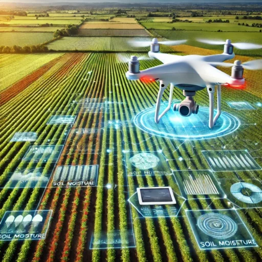
Drone agriculture mapping uses UAVs to capture high-resolution images of agricultural fields. These images are then processed into high-resolution maps, providing an overview of crop health, soil conditions, irrigation practices, and pest or disease issues.
Agriculture drones enable stakeholders to focus on the landscape where it matters most, using data to guide precise field interventions. These interventions save time, money, energy, and water. Other methods and technology-led initiatives often fail to deliver real-time data, which is crucial for decision-making.
Drone agriculture mapping helps modern agribusinesses stay ahead by providing invaluable aerial surveillance data for a wide range of agronomic applications.
Innovative Use of 3D Drone Mapping and Imaging in Modern Agriculture
| Feature | Description | Benefits |
| Terrain and Soil NDVI Mapping | Measures salinity, soil health, and elevation with 3D maps. Generates soil analysis reports for water and nitrogen management. | Aids in soil research, crop placement, and optimized resource planning. |
| Prescription Mapping | Targets specific areas for spraying fertilizers, herbicides, and pesticides to reduce waste and overuse. | Protects healthy crops, minimizes resource costs, and ensures precise application. |
| Crop Assessment | Drones autonomously collect data to identify plant stress and evaluate treatment effectiveness. | Drones autonomously collect data to identify plant stress and evaluate treatment effectiveness. |
| Plant Population Counting | Uses AI to identify plant types and calculate production and losses at the start and end of the season. | Provides accurate data for evaluating crop success and improving future planning. |
| Automatic Land Classification | Identifies land type (arable, pastoral, or mixed) and tracks livestock or crop counts. | Maintains updated records, highlights losses, and ensures better land management. |
| Tracking Crop Health | Monitors factors like temperature, humidity, pests, and nutrient levels; applies solutions directly to problem areas. | Improves crop health, enhances resistance to diseases, and optimizes growing conditions. |
Significance of Drone Mapping for Agriculture in B2B
Drone agriculture mapping is a powerful tool for B2B companies working with farmers. Amid rising competition, B2B enterprises can leverage high-end drone technology to provide tailored solutions to agricultural businesses, cooperatives, or service providers, positioning themselves as leaders in advanced farming methods.
Drone mapping offers value addition in the following ways:
- Accurate Soil Measurement
Drones offer detailed maps for the company to help its clients make the right decisions on how to treat their soil, which fertilizers and irrigation strategies to use.
- Timely Crop Monitoring
Furthermore, data coming from a drone with multispectral cameras indicates nutrient deficiencies or unapparent water stress, hence allowing a client to act quickly and effectively.
- Pest and disease control management
It provides early detection of pest infestations and diseases and leads to targeted interventions that may reduce chemical use, cut costs, and minimize environmental impacts.
- Effective Irrigation Management
In addition, in water-starved regions, drone agriculture mapping helps spot dry areas and over-irrigated regions, thus allowing clients to optimize water consumption while sustaining crop health.
- Higher Productivity and ROI
By offering smart resource management, drone mapping helps the agricultural firm optimize yield without increasing costs, meaning a bigger ROI for clients.
The Competitive Advantage of Drone Solutions for B2B Markets
These days, modern UAVs provide much better advantages in adaptability, cost, and data processing speed compared to traditional methods for B2B companies interested in drone agriculture mapping solutions.
- Adaptability for Local Conditions
Agro-aviation drones are toughly built to withstand the various and, at times, demanding conditions of the farmland. Designed to work effectively in scorching heat, heavy dust, and rugged terrain, UAVs assure durable and stable performance. Additionally, their adaptability makes them the ideal solution for companies keen on catering to diverse agricultural enterprises through effective agriculture drone mapping.
- Value for Money
In India, where costs can be sensitive, advanced drone technology is now more accessible. Agricultural enterprises can invest in high-quality solutions that are quite affordable. The agricultural drone market is expected to rise from USD 6.11 billion in 2024 to USD 23.78 billion by 2032, according to a recent market report. This eventually points to a larger increase in affordability and accessibility in drone technology.
- Processing Speed
Modern agricultural drones are designed for rapid data acquisition and processing, offering real-time insights that are vital for timely decision-making. Fast aerial image analysis and actionable insights from agriculture drone mapping provide B2B businesses with a significant competitive edge.
- Local Infrastructure and Knowledge
What really sets these drone solutions apart is their local infrastructure to support firms adapting to such technology. There is full technical support, including drone servicing, training programs for clients, and expert consultations round the clock. Localized knowledge provides companies with efficient reach into rural areas where global suppliers may struggle.
Why Drone Technology is the Ultimate B2B Solution
Modern agricultural drones offer a completely scalable and cost-effective solution for B2B companies in the agritech sector. They address various challenges that farmers may face—unpredictable weather, disparate soil types, and more. Their superior imaging and mapping technology, combined with reliable local support, enable businesses to understand their customers better and provide the best sustainable solutions through agriculture drone mapping.
FAQs
What is drone mapping in agriculture?
Farm mapping is the use of drones to capture high-definition pictures of farms in making maps that illustrate information about plant health, soil, irrigation, pests, and other related matters for effective management of farms.
How do B2B companies apply drone mapping to their advantage?
Thanks to drone mapping, B2B companies can give precise soil testing, pest analysis, irrigation management, and crop monitoring. As a result, the ROI and customer satisfaction are raised.
What makes it easy for self aerial mapping drone systems to be used in agriculture?
Drones are cheap and readily available technology that can offer real time services with 3D mapping and other local services making it suitable for developing agriculture as a business.
Final Thoughts
Drone agriculture mapping is transforming the face of agriculture, where the future of farming will be data-centric, efficient, and a sustainable business. The acceptance of drone technology into any B2B firm looking to offer its agricultural customers innovative high-performance solutions has almost become a requirement. This is necessary to remain competitive in this rapidly expanding agri-tech market.
Equipped with cutting-edge drone mapping technology for agricultural enterprises, you will be able to incorporate such advances. These can empower the agricultural clients of your agribusiness.