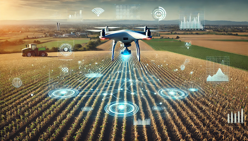
The modern combination of drones combined with artificial intelligence (AI) transforms the way farmers traditionally do soil management. Mapping of soil health, composition, and variability has always been quite difficult for farmers. But due to all the agricultural drones and AI-supported soil mapping technology, farmers can now easily perform the task. The combined efforts are uncovering the real secrets of soil, opening the gate for farmers to unleash potential optimization in farming practices and drive productive performance.
In this blog, we are going to discuss how agri drones assist in soil mapping and what their benefits are.
The Role of Agri Drones in Soil Mapping
Traditionally, soil testing involved a long and arduous process where samples from different areas of a given field were taken out for laboratory analysis. In most respects, it worked rather well but was often very time-consuming and expensive; in any event, it encountered some inefficiency.
The agri drones carry various sensors and imaging technology. These technologies enable them to cover enormous pieces of land in much less time compared to household collection methods and soil analysis. Additionally, they rely on multispectral imagery, hyperspectral, and thermal sensors. These sensors provide high-resolution images of soil surfaces while capturing data such as temperature, moisture content, and the amount of organic material in the soil.
By flying over fields and capturing soil data, drones produce detailed imagery. This imagery can then be processed and analyzed for soil mapping. As a result, farmers gain an overview of land conditions. This allows them to create action plans for irrigation, fertilization, and crop management.
AI-Powered Soil Mapping: Making Sense of the Data
Drones have the capacity to collect and transmit vast volumes of data. It is AI that processes raw data into useful predictive insights. AI-powered algorithms analyze the data from drones to produce accurate soil maps depicting soil health, its texture, pH, moisture, and other parameters that can predict crop performance.
AI systems are already capable of discovering patterns and correlations that are hard for humans to imagine. They achieve this through machine learning and deep learning techniques. For example, AI can evaluate how soil reacts to the climate. It can identify areas lacking nutrients and recommend the appropriate phase of fertilization for each segment of the field.
Their ability to learn through adaptive mechanisms will allow these AI systems to grow more sophisticated over time. As more and more predictions and data are fed into the system, the accuracy of the AI predictions and recommendations increases, allowing the farmers to tweak their plans and enhance productivity over the long haul.
They will be able to improve with usage; long story short, the more predictions and data run through the AI system, the more reliable its predictions and recommendations become. Consequently, farmers are left with the means to redesign their planting frameworks, which eventually improves sustainability.
Benefits of AI-Powered Soil Mapping with Agri Drones
- Precision Agriculture: AI-guided soil mapping enables farmers to practice precision agriculture by permitting the use of inputs, for example, water and fertilizers, only where needed. This reduces waste and costs while promoting soil health and increased crop yield.
- Efficiency: The speed and accuracy at which soil data gets collected enable farmers to apply their methodology in a timely manner. Drones and AI provide real-time insight that helps curb problems before they get out of hand.
- Sustainability: Optimized resource utilization, such as that done by AI-guided soil mapping, fosters agricultural sustainability. Lesser usage of chemicals therefore preserves soil fertility and diminishes pollution.
- Healthier Crops: For healthier crops, farmers need healthier soil. Farmers could target intervention schemes to places gerontologists have identified with lesser soil health, thereby ensuring a substantial improvement in quality and yield.
Study on Gamma-Ray Spectrometers in Drones for Soil Mapping
The following table shows the efficiency of using drones with gamma-ray spectrometers in soil property mapping. It illustrates the process from deploying the sensor to collecting radiation data. Next, AI models are applied to correlate radionuclide concentrations with soil characteristics. Finally, highly detailed maps are generated, showing soil composition and contamination levels.
Soil mapping is made more affordable, accurate, and less invasive through drones Extension, particularly in sensitive and hard-to-reach locales.
| Step | Description | Technology Used | Outcome |
| 1. Sensor Deployment | The sensor detects radiation from naturally occurring radionuclides, including potassium, uranium, and thorium, from the spectrometer mounted on a drone flying over the target area. | Gamma-ray Spectrometer (e.g., MS-1000 sensor) | Collection of radiation data to measure the concentration of radionuclides in soil. |
| 2. Data Processing & Application Model | An application model is utilized to analyze the data collected, correlating radionuclide concentrations with aspects of soil properties, such as clay content or contaminant levels. | AI Algorithms and Application Models | Translation of radionuclide data into specific soil property maps (e.g., clay fraction, contaminant levels). |
| 3. Map Generation | Soil properties maps created provide insights on soil composition, texture, and contamination level from processed data. | GIS Software, Mapping Tools | Creation of detailed soil maps showing variations in soil properties across the field. |
This process facilitates efficient and non-invasive soil mapping, providing accurate and timely data for applications like environmental studies and agricultural management.
FAQs
How do agri drones map soil?
Agri drones use sensors to capture data on soil moisture, temperature, and texture. This data is analyzed by AI to create accurate soil maps that reveal soil health and variability.
What are the benefits of AI soil mapping?
AI-powered soil mapping enables precision farming, improving resource efficiency, reducing costs, enhancing crop yields, and promoting sustainable practices.
Can AI mapping improve soil health?
Yes, AI mapping helps identify soil issues and optimize fertilization, promoting better soil health, fertility, and long-term sustainability.
Conclusion
With the progress in the field of technology, the potential of agri drones and AI in the soil mapping domain is immense. Moreover, as other technological innovations continue to spread, they might, in the future, witness the rise of even more advanced sensors and AI algorithms that offer deeper insights into soil conditions. Consequently, this could lead to the emergence of sophisticated dynamic soil maps that could guide automated farm machines. Ultimately, these maps will heighten efficiency and precision in farming.
Moreover, with the incorporation of other technologies such as blockchain for secure data sharing and IoT devices for real-time monitoring, there will be an even more interconnected and data-driven smart culture of farming.