Today, the effective use of water in irrigation management has become increasingly important due to global concerns about water scarcity and the need to advance modern agriculture. Technology now plays a crucial role in driving these revolutionary changes.
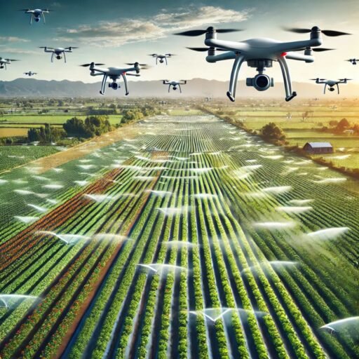
Agricultural drones, also called ‘agri’ drones, are one of the key technological advancements addressing the challenges of irrigation management. They help reduce the burden on farmers while minimizing water resource usage. These UAVs can collect real-time data, enabling farmers to make precise decisions about irrigation and water management, ultimately preventing potential wastage.
In this blog, we’ll explore how agri drones are transforming irrigation management.
The Technology Behind Agri Drones in Irrigation Management
Agri drones equipped with advanced sensors, including multispectral, thermal, and near-infrared (NIR) cameras, are revolutionizing how farmers manage water resources. Here’s how the technology helps in irrigation management:
- Thermal Imaging Sensors
These drones use thermal imaging sensors to identify temperature variances in the crops and soil, which indicate the areas that are either too dry or too wet. Consequently, drones can scan huge fields rapidly, thus generating high-resolution heat maps with stressed zones. Therefore, farmers will be able to detect the water-stressed areas quickly, making irrigation targeted, thus preventing water wastage. Thus, this approach reduces the loss of water, thus ensuring irrigation management is efficient and sustainable. - Multispectral Imaging
Multispectral sensors on camera drones detect the reflected light in combinations of various wavelengths. In an effort to provide data about the health status of plants, chlorophyll levels have been targeted, with the idea that since chlorophyll is closely related to water content, it can help farmers know what parts of a field need more watering. - NDVI Analysis
The Normalized Difference Vegetation Index (NDVI) is another standout characteristic of agricultural drones. NDVI maps, produced from data captured by drones, help farmers assess health and vigor in crops. NDVI can address the irrigation requirement of the farm by monitoring how the crops absorb light and reflect it. - Real-time Monitoring and Automation
Modern agricultural drones can be configured with smart irrigation systems and monitor soil moisture levels in real-time. Some systems even allow for irrigation to be done automatically, based on the data collected by the drones, thereby adjusting the water delivery according to real-time crop needs.
Benefits of Agri Drones in Irrigation Management
The multi-purpose benefits of agri drones towards irrigation management include accuracy in applying water, cost cutting, and sustainability. Additionally, the drones enhance crop yield since they optimize water use. Here are the essential discussion points on how the drones work in optimizing efficiency, minimizing waste in water, and leading to health crops:
- Precision Irrigation
With drones, the guessing game is out. The information obtained directly measures water requirements and applies the same amount in specific fields to prevent excess or insufficient allocation of water.
- Cost-Effective
With the right use of water, reduced wastage, and other such sub-optimized water utilization, agri drones can thus help lessen irrigation costs as well as those generated from energy used to pump water.
- Sustainability
Effective irrigation via drones, therefore, decreases the agricultural water footprint as a whole. It becomes highly relevant in areas where water resources are scarce
- Improved Crop Yield
Proper use of water will result in healthy crops, which indeed will result in improved crop yield. Overwatering and underwatering are stopped due to agri drones. Thereby it maintains crops within optimal conditions during their growing cycle.
Technical Overview of Agri Drone Sensors
- Thermal cameras: Generally, the thermal camera is an infrared sensor used for sensing temperature changes of plants and soils. This sensor is capable of detecting temperature changes as small as 0.1°C, thus placing it in an ideal situation to identify water stresses in crops.
- Multispectral: These cameras can take photographs in several light spectrums (e.g., visible, infrared, and red-edge) to provide detailed information about plant health and soil moisture at the various levels.
- Lidar: In some agri drones, Lidar technology is used to map field topography. This helps to design efficient irrigation systems by pinpointing slopes and areas of waterlogging in the field.
Enhancing Irrigation Management with Drone Technology in Maharashtra
According to ResearchGate’s case study, drone technology has transformed irrigation management by enabling precise crop assessment and efficient area measurement, boosting transparency and revenue.
The table below outlines the specifications of drones used for irrigation, focusing on Fixed-Wing and Quad Copter models, which enhance water management and crop identification.
| Aspect | Details |
| Purpose of Drone Use | Measuring irrigated area and identifying crop types in Maharashtra’s irrigation sector. |
| Key Results | – Increase in irrigated area from 10.71 lakh ha to 13.884 lakh ha.
– Revenue boost by ₹50 crores. |
| Benefits of Drone Surveys | – Accurate crop identification and area measurement.
– Enhanced transparency and efficiency in operations. – Reduced manpower dependency. – Cost-effective at ₹156/ha. |
| Challenges in Water Management | – Competition for water resources among sectors.
– Poor irrigation service delivery and fragmented water resource management. |
| Survey Methodology | – Area selection using Google Earth.
– Flight planning with specialized software. – Actual survey with drones maintaining 30–40% photo overlap. |
| Drone Specifications |
Fixed Wing Drone: Covers 4–5 sq. km/flight, flight duration 90 mins. Quadcopter Drone: Covers 2–4 sq. km/flight, flight duration 45 mins. |
FAQs
In what ways do agri drones play a role in conserving water in irrigation management?
Drones are equipped with thermal and multispectral imaging which enables them to provide soil moisture and crop health data. Additionally, they help in ensuring the design of irrigation systems prevents over watering by ensuring that the right targets are covered and the right amounts of water applied to the right targets.
Are agri drones user friendly for irrigation applications?
Yes, modern agri drones are easy to use and have interfaces that anyone can handle. In most cases, they are accompanied by data analysis software that translates collected data into serviceable information. Most of such systems work together with the already existing irrigation equipment quite easily.
Can agri drones be used regardless of crop types?
Yes, agri drones are considered flexible tools that can be employed in irrigation management. They can manage different types of crops, including but not limited to cereals, fruits, and vegetables. The information collected is responsive to the specific conditions of each field, ensuring the technology’s resilience to various farming practices.
Conclusion
In current agricultural trends, the proper use of water is more important than ever. The recent global challenges surrounding water shortages and the shift towards sustainable agriculture have become a driving force for the evolution of new varieties, with technology playing a critical role.
Among the notable advancements helping to ease the management of irrigation systems while utilizing minimal water resources are agricultural drones, or ‘agri drones.’ These UAVs can collect real-time data, enabling farmers to make informed decisions on water and irrigation management, ensuring minimal loss.