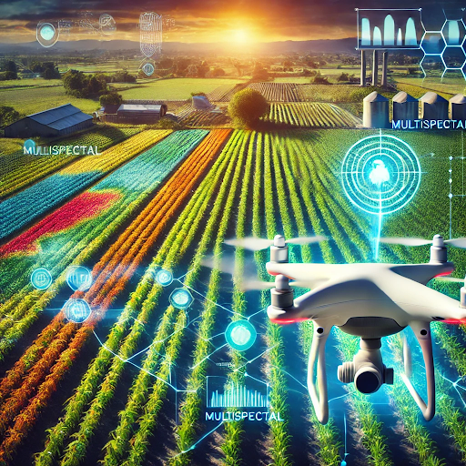
In the changing agricultural landscape, technology has opened up tremendous transformational opportunities in farming. Advanced drone imagery technology illuminate areas that were previously uncharted. Drones cover large areas very quickly and efficiently, making it easy for farmers to monitor their lands effectively.
To make detailed assessments regarding crop health, irrigation systems, and other issues before they worsen, high-resolution images from drones are critical. Through multispectral and thermal imaging techniques, stresses in plant life, nutrient deficiencies, and pest infestations can be detected at an early stage.
Moreover, it increases productivity and supports more sustainable farming through the accurate allocation of resources. The danger of climate change and unbounded food demand makes the incorporation of drone imagery in farming practices even more important. Therefore, this technology, for the farmer, serves as an opportunity for making good decisions that change crop yields and safeguard a more resilient agricultural system.
The Power of Hyperspectral Drone Imagery in Agriculture
Hyperspectral imaging by drones provides valuable data in monitoring the healthiness of crops and soils. Unlike conventional methods of imaging, hyperspectral sensors gather hundreds of spectral bands, providing an increasingly detailed view of agricultural conditions. The advanced technology enables farmers to monitor crop health, identify early signs of disease or stress, and assess properties of soil, as well as monitor levels of water stress.
Hyperspectral imaging can help farmers make informed decisions in crop management and yield optimization by identifying subtle variations that are invisible to the naked eye.
Below is a table outlining key applications of hyperspectral imaging in agriculture, highlighting how this technology enhances farming practices and improves decision-making.
| Study Focus | Technology | Key Findings |
| Crop Yield & Biomass | Drone hyperspectral imaging | Improved yield prediction accuracy |
| Crop Classification | Deep learning, hyperspectral | 97% accuracy in crop classification |
| Canopy & Shadows | Hyperspectral, CNN | Enhanced spectral analysis of wheat canopy |
| Diurnal Effects | Time-series hyperspectral | Predictable diurnal patterns in phenotyping |
| Nutrient Status | Hyperspectral, machine learning | Thermal imagery |
| Pest & Disease Detection | Hyperspectral, spectral analysis | 98% accuracy in pest detection |
| Virus Detection | Hyperspectral, optical sensors | High accuracy in virus detection |
(source)
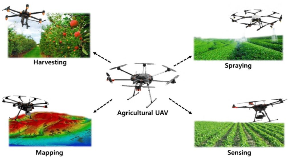
Technology for Capturing Drone Imagery
A range of drone technology and sensors are utilized to obtain clear images. Regular cameras offer clear images but are limited to general surveillance. Multispectral cameras, on the other hand, evaluate the growth and health of crops in various wavelengths. Moreover, infrared cameras scan for heat patterns in order to diagnose issues with water levels and irrigation. LiDAR or Light Detection and Ranging is a mode of remote sensing technology that captures data on three-dimensional surfaces. These technologies combined improve the agriculture assessment and management processes.
The Role of AI in Analyzing Drone Imagery
The process of acquiring data is just one part. The application of AI is paramount to making sense of this data. AI-powered solutions, such as machine learning and computer vision, help in understanding imagery. They process and analyze huge amounts of data. These technologies find patterns or even spot anomalies. Therefore, the combination of drone imagery and AI enables farmers to address issues like crop diseases or irrigation problems before they escalate.
The Challenge of Data Storage and Fault Detection
Apart from capturing high-resolution images through drones, there is also a need to store such enormous imagery in a safe and efficient way after capture. Today, the challenge facing the exploitation of aerial data is storing such large volumes of imagery safely and efficiently. The fast development of drone technology coupled with the deployment of UAVs in most sectors today results in huge amounts of data being generated daily. Hence, there is a need for a high-capacity image storage system that can accommodate this rise in data creation.
This challenge is addressed through the innovative use of cloud-based storage to safely host captured drone imagery, keeping it accessible and secure from data loss. The ample storage facility, provided by cloud infrastructure, allows users to retrieve their data from anywhere. This also leads to real-time analysis and decision-making processes.
The system not only stores data but also analyzes images to identify faults and anomalies in raw data, converting it into actionable insights. Users can optimize operations by focusing on areas that require irrigation or where there is evidence of infestation. They can adjust irrigation schedules based on actual information and modify sprinkler controls to increase water conservation and operational efficiency.
The integration of advanced data analysis, image storage, and comprehensive reporting enables the system to deliver efficient data management processes. This empowers users with ways to increase productivity and sustainability in their operations.
FAQs
What types of data can drones collect in agriculture?
Drones with RGB, multispectral, and thermal imaging can provide valuable information regarding crop health, soil conditions, and water stress.
How does AI enhance drone data analysis?
AI algorithms scan the entire imagery to find patterns and anomalies, saving farmers’ time in spotting anomalies.
What are the biggest challenges for implementing drone technology in agriculture?
Major challenges include data integration, privacy of information, and adequate farmer education on the use and possibilities of drone operations.
How do farmers benefit from using drones and AI?
Using drone imaging and AI analysis lets the farmer leverage this decision-making for healthier crops, greater yields, and sustainable practices.
Conclusion
The integration of drone imagery and AI analysis transforms agriculture by boosting efficiency and enhancing productivity. It promotes healthier crops through real-time insights provided to the farmer. Powered by drone imagery, agriculture is moving toward more sustainable and profitable practices. This shift ensures long-term growth and resilience in the industry.